Google City Guide to Budapest
This project visualizes the massive amount of data that Google collects about its users. The book primarily revolves around ‘My Timeline’ within Google Maps. This feature is often enabled by default on Android devices, while on iOS devices, it can be manually enabled. This feature automatically tracks where you have been and how long you stayed there.
This tangible implementation presents data collected during a five-day vacation in Budapest, Hungary. The work is designed as a travel guide that could even be automatically generated by Google itself in the future. Ironically, this kind of data is often collected without our knowledge.
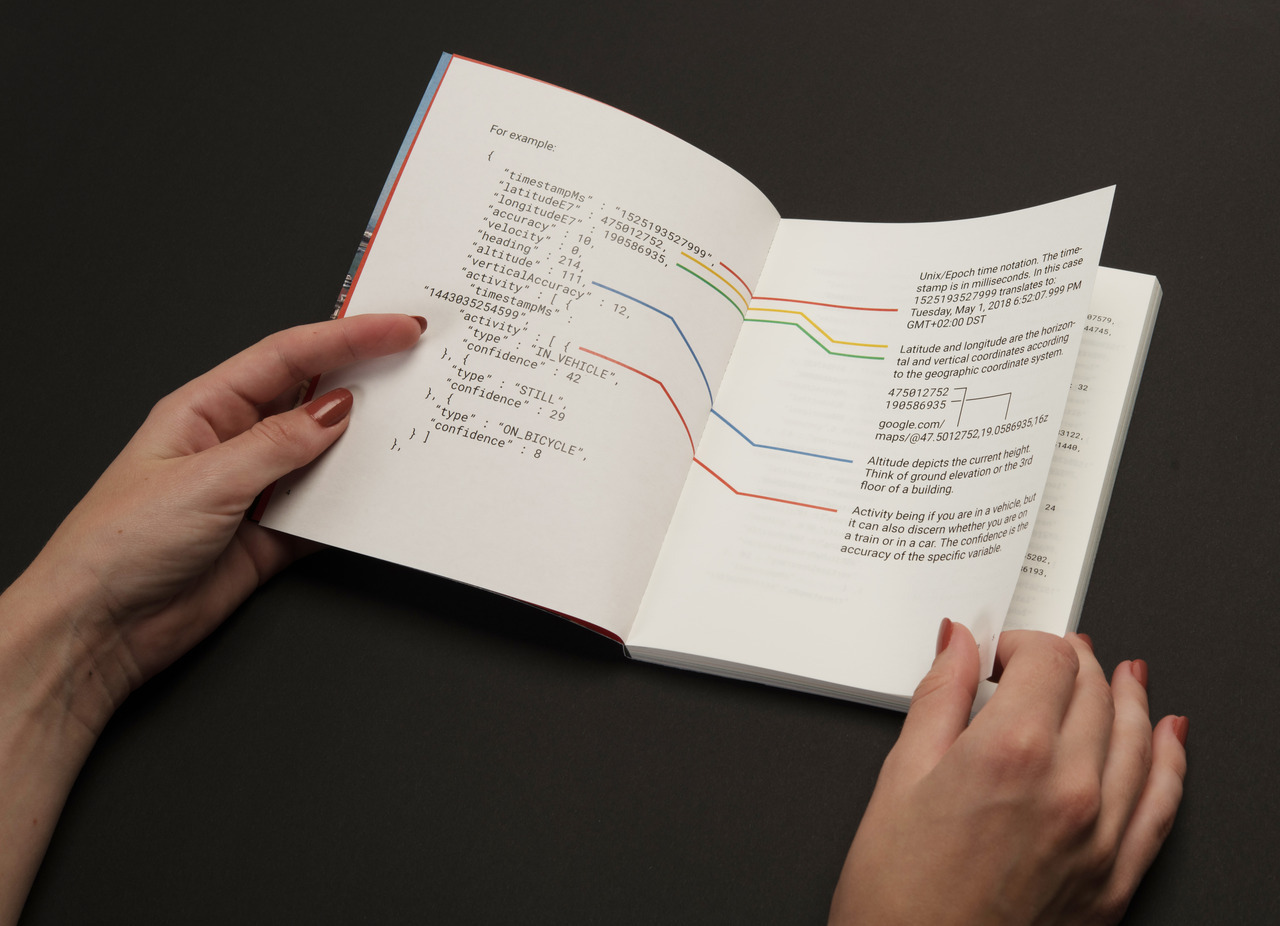
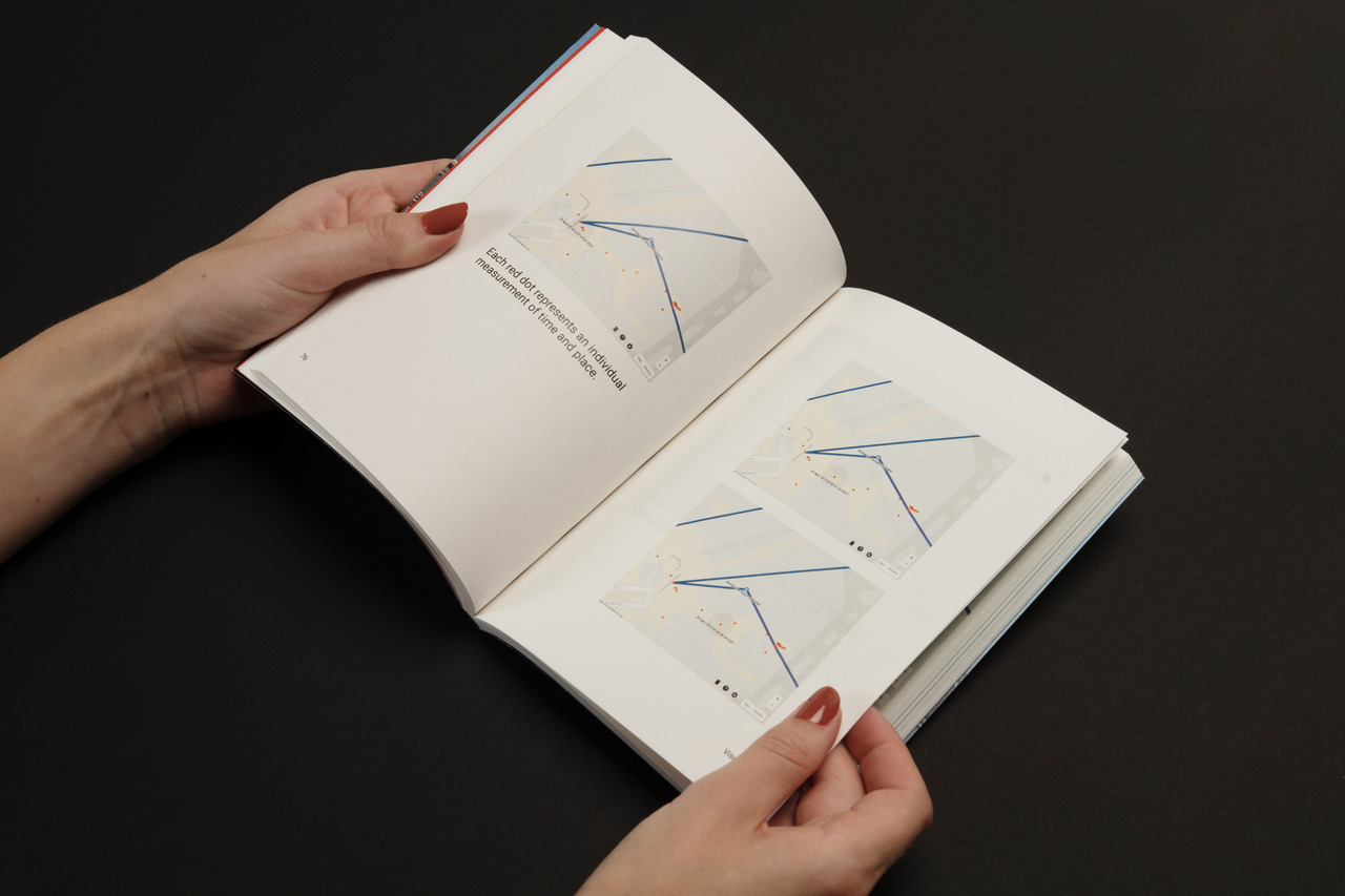
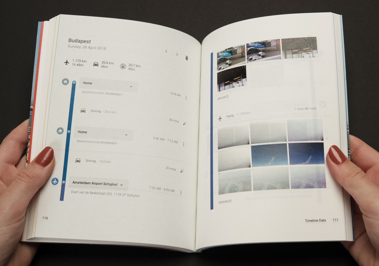
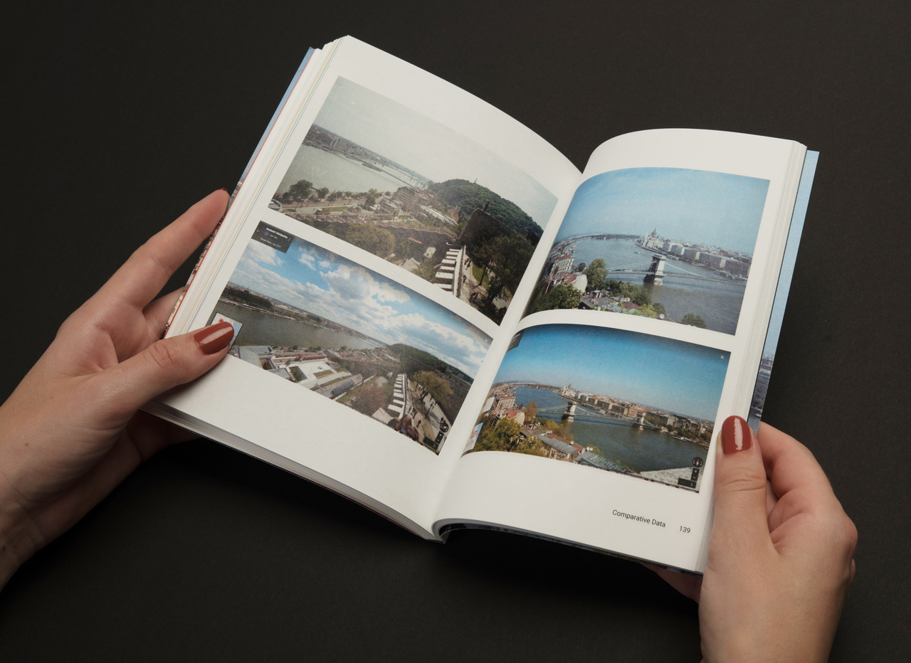
The book is divided into several chapters. The first chapter displays raw data: timestamps, movement, latitude, and longitude. The second chapter focuses on visual data: the raw data compiled and visualized in Google Maps. The third chapter presents timeline data — the data from the previous chapter is organized in a clear list, allowing you to see the places visited. The final chapter delves into comparative data: comparing the photos taken by Google with those captured using an analog camera. Remarkably, Google is capable of capturing the exact same photos as a human.
Book details
Paperback
Language: English
Data collected by Google.
This project is a collaboration with Stijn Zeilstra